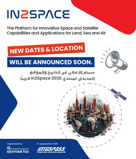
New Dates Coming Soon – In2space Forum 2026
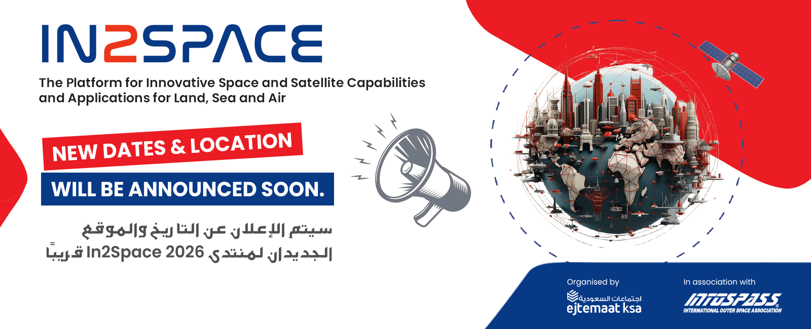
We sincerely appreciate your support and interest in the In2space Forum 2025. Due to unforeseen challenges affecting several confirmed speakers, participants, and hosts, the event scheduled for 24–25 November 2025 will be postponed.
We remain fully committed to hosting the forum in person to enable meaningful discussions and networking.
A new date, planned for the second quarter of next year, along with potential venue updates, will be announced shortly.
Your support is invaluable, and we look forward to welcoming you next year to maximise benefits for all participants. We apologise for this necessary change and thank you for your understanding.
Welcome to In2Space Forum
Exploring Terrestrial Innovation Through Satellite Technology
In2Space is an innovative conference dedicated to showcasing the vast terrestrial applications enabled by satellite-based remote sensing, navigation, and telecommunications. Hosted in the heart of Riyadh, KSA, this premier event offers a unique platform for satellite developers, technology providers, and end-users to connect, collaborate, and drive innovation across industries.
About the Conference : In2Space brings together global and regional leaders from both traditional and new-space sectors alongside experts in ground-based satellite infrastructure. The conference will feature insightful presentations, interactive workshops, and a dynamic exhibition floor highlighting the latest developments across the full satellite ecosystem.
Technical Workshops : Engage in topic-specific workshop sessions that connect upstream satellite developers with downstream users of satellite data. These workshops are designed to: Identify gaps in existing satellite data and services Inspire next-generation satellite concepts Develop top-level requirements for future missions
Each session will be moderated by subject matter experts, who will summarise key findings and outline recommendations based on the discussions.
AI & Data Fusion Roundtables : Explore cutting-edge approaches to satellite data processing and management. Roundtable discussions will focus on: Leveraging AI for multi-source data fusion Integrating data from diverse satellite platforms and ground-based sensors
Addressing real-world challenges in data volume, speed, and usability
These sessions aim to unlock new potential in sectors such as agriculture, urban development, environmental monitoring, and smart infrastructure.
Technology Exhibition : Discover the latest advancements in both upstream and downstream space technologies. The exhibition will showcase products and services from satellite manufacturers, infrastructure providers, analytics platforms, and data users.
Welcome to In2Space Forum
Exploring Terrestrial Innovation Through Satellite Technology
In2Space is an innovative conference dedicated to showcasing the vast terrestrial applications enabled by satellite-based remote sensing, navigation, and telecommunications. Hosted in the heart of Riyadh, KSA, this premier event offers a unique platform for satellite developers, technology providers, and end-users to connect, collaborate, and drive innovation across industries. Read More
About the Conference : In2Space brings together global and regional leaders from both traditional and new-space sectors alongside experts in ground-based satellite infrastructure. The conference will feature insightful presentations, interactive workshops, and a dynamic exhibition floor highlighting the latest developments across the full satellite ecosystem.
Technical Workshops : Engage in topic-specific workshop sessions that connect upstream satellite developers with downstream users of satellite data. These workshops are designed to: Identify gaps in existing satellite data and services Inspire next-generation satellite concepts Develop top-level requirements for future missions
Each session will be moderated by subject matter experts, who will summarise key findings and outline recommendations based on the discussions.
AI & Data Fusion Roundtables : Explore cutting-edge approaches to satellite data processing and management. Roundtable discussions will focus on: Leveraging AI for multi-source data fusion Integrating data from diverse satellite platforms and ground-based sensors Addressing real-world challenges in data volume, speed, and usability
These sessions aim to unlock new potential in sectors such as agriculture, urban development, environmental monitoring, and smart infrastructure.
Technology Exhibition : Discover the latest advancements in both upstream and downstream space technologies. The exhibition will showcase products and services from satellite manufacturers, infrastructure providers, analytics platforms, and data users. Read Less
Vision
In2Space aims to bring together government bodies, private organizations, and SMEs working in application areas to explore innovative solutions to the challenges they face, with support from experts across both the public and private sectors.
Satellite-based application and innovation providers will have the opportunity to showcase their new projects and products, as well as gain first-hand knowledge from end users at the conference about their needs and how they can be addressed.
In2Space aims to empower decision-makers from regional government entities with a vested interest in developing the space sector. This includes space agencies, technology providers, and application developers. The conference will serve as a platform to discuss how to build a sustainable and economically viable regional space ecosystem — one that attracts established international companies and fosters the growth of innovative startups.
In2Space Leadership Talks
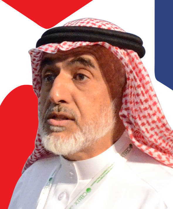
An Exclusive Conversation with Dr. Fahad AlTuwaijri on Shaping the Future of Space Innovation
In this insightful interview, Dr. Fahad AlTuwaijri, a key visionary behind In2Space, shares his perspective on the region’s emerging space sector, the strategic importance of collaboration between government, private sector, and startups, and how In2Space aligns with Saudi Arabia’s Vision 2030. He discusses the critical steps needed to build a sustainable and economically viable space ecosystem, while highlighting opportunities for innovation and regional leadership.
Why In2Space?
In2space is a forum for showcasing the latest innovations in the space sector relating to satellite payload instrumentation and all kinds of terrestrial applications designed to support Earth’s sustainability and security. The forum is also a platform for discussing challenges for space programmes such as funding and investments, space policy, regulations and law with a focus on how to ensure that space can continue to be used for the benefit of all humanity.
In2space attendees will have the opportunity to join panel discussions and debates that will include a large gathering of government and the private sector professionals including policy and decision-makers, who benefit from space data and services, such as environmental agencies (water resource management and air pollution), municipalities (e.g. urban planning), agriculture (crop management), insurance (risk assessment and impact of damage), maritime agencies (monitoring illegal fishing activities and piracy), and security (monitoring critical assets such as oil and gas).
Why In2Space?
The conference, though focusing on innovation, will not discuss the technology in itself; rather, it will focus on how latest satellite and space technology can drive innovative products and services that could serve and benefit the users.
In2space is a forum for showcasing the latest innovations in the space sector relating to satellite payload instrumentation and all kinds of terrestrial applications designed to support Earth’s sustainability and security. The forum is also a platform for discussing challenges for space programmes such as funding and investments, space policy, regulations and law with a focus on how to ensure that space can continue to be used for the benefit of all humanity.
Host working group (WP) and science advisory group (SAG) meetings for ongoing as well as projects in the planning stage with the aim of generating recommendations and declarations at the end of these meetings that can be presented to and socialise with government and private sector decision and policy makers.
- The In2Space conference, while focusing on innovation, will not discuss technology in itself; rather, it will explore how the latest satellite and space technologies can drive innovative products and services that serve and benefit users.
- In2Space will host Working Group (WG) and Science Advisory Group (SAG) meetings for ongoing projects as well as those in the planning stage. The aim is to generate recommendations and declarations at the end of these meetings, which can be presented to and socialized with government and private sector decision- and policy-makers.
- In2Space will debate and discuss how to encourage cooperation both locally and across borders to maximize the utilization of existing space capacities and expertise while planning for new facilities and projects. The aim is to demonstrate how such cooperation can provide socioeconomic benefits to all parties involved—especially if it leads to reducing or sharing the burden of funding.
- In2Space welcomes government and private sector professionals, including policy- and decision-makers across the globe, who are interested in accessing end-user services and data products aimed at:
- Environmental agencies (e.g., water resource management and air pollution)
- Municipalities (e.g., urban planning)
- Agriculture (e.g., crop management)
- Insurance (e.g., risk assessment and impact of damage)
- Maritime agencies (e.g., monitoring illegal fishing activities and piracy)
- Security (e.g., monitoring critical assets such as oil and gas)
Distinguished Speakers

H.E. Dr. Sherif Sedky
Chief Executive Officer@@Egyptian Space Agency

H.E. Dr. Sherif Sedky
Chief Executive Officer@@Egyptian Space Agency
H.E. Dr. Sherif Sedky has 33 years of regional and international experience in international academic institutions in the Middle East, Europe and the United States. In August 2022, the President of Egypt issued a presidential decree for appointing Dr Sedky as the Chief Executive Officer of the Egyptian Space Agency. He is the Chair of the United Nations Committee for Peaceful Uses of Outer Space (UNCOPUOS), and the Chair of the Arab Space Cooperation Group.

Prof. Adriano Camps
President@@IEEE-GRSS Spanish chapter

Prof. Adriano Camps
President@@IEEE-GRSS Spanish chapter
Prof. Adriano Camps joined the Dept. of Signal Theory and Communications, Universitat Politècnica de Catalunya (UPC), as an Assistant Professor in 1993, Associate Professor in 1997, and Full Professor since 2007. In 1999, he was on sabbatical leave at the Microwave Remote Sensing Lab., of the Univ. of Massachusetts, Amherst. Since September 2022 he has been an ASPIRE Visiting International Professor at the UAE University, Al Ain, Abu Dhabi.
His research interests are focused on:
1) microwave remote sensing, with special emphasis on microwave radiometry by aperture synthesis (Ph.D. Thesis about the MIRAS instrument, which became the single payload of ESA’s SMOS mission), 2) remote sensing using signals of opportunity (GNSS-R), 3) radio frequency interference detection and mitigation, 4) ionospheric propagation, and 5) nanosatellites as a tool to test innovative remote sensors.
His publication record includes over 268 papers in peer-reviewed journals, 9 book chapters, and the book Emery and Camps, “Introduction to Satellite Remote Sensing. Atmosphere, Ocean, Land and Cryosphere Applications,” Elsevier, 2017, 860 pages), and more than 541 conference presentations. According to Google Scholar, his h-index is 66, and his publications have received more than 17338 citations. According to the October 2023 Stanford ranking, he is among the top 2% of researchers in all categories.

Louise Baker
Managing Director of the Global Mechanism @@United Nations Convention to Combat Desertifcation, UNCCD

Louise Baker
Managing Director of the Global Mechanism @@United Nations Convention to Combat Desertifcation, UNCCD
Ms. Baker joined the UNCCD secretariat in March 2011 and served as Coordinator of the External Relations and Policy Unit of the United Nations Convention to Combat Desertification Secretariat. In this role, Louise led work on policy development, communications, advocacy and partnerships.
Originally from a rural farming community in the United Kingdom, in August 2020, Executive Secretary Mr. Ibrahim Thiaw appointed Ms. Louise Baker, as the Managing Director of the Global Mechanism of the United Nations Convention to Combat Desertification (UNCCD). The Global Mechanism supports resource mobilization for country level implementation of the Convention.
Previous United Nations assignments include high-profile public health campaigns on immunization, tuberculosis and tobacco control for the World Health Organization. She has lived and worked extensively in Central and Eastern Europe and Asia.
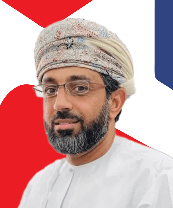
Dr Saoud Humaid Al Shoaili
Head@@National Space Program, Ministry of Transport & ICT, Oman

Dr Saoud Humaid Al Shoaili
Head@@National Space Program, Ministry of Transport & ICT, Oman
Dr Saoud is a renowned national executive leader with a professional experience over 21 year’s in the ICT (ICT, Post, and Space) sectors. He is a professional management consultant & Advisor to the ministry on the ICT, Post & Space fields. His professional experience includes sector legislation and regulations, policy, strategic planning and execution, governance and compliance. He represents the sector at various regional and international events. Dr Saoud has led various legislative, policy and strategic initiatives that has impacted the sectors including ICT law, Personal data law, national ICT strategy, National Cloud 1st Policy, Postal Sector Policy & Executive Strategy, National Space Policy & Executive Strategy beside others. He has been invited as a Guest of Honor and keynote speaker in various forums.
Dr Saoud is a board member in various local and international BoDs including the UPU, ArabSAt Co, ITHCA- ICT Holding CO and UN-Regional Centre for the Space Science & Technology Education. He is also the country representative in the ITU. Dr Saoud holds PhD/MSc in Public Policies for Science, Technology & Innovation, besides MEng/BEng in Electrical & Computer Engineering. He is a graduate among the first cohort of the National Leadership & Competitiveness Program (Diwan Royal Court/University of Oxford).

Dr. Driss El Hadani
Deputy Director / Senior Adviser for@@Space Science and Education United Nations Office for Outer Space Affairs (UNOOSA)

Dr. Driss El Hadani
Deputy Director / Senior Adviser for@@Space Science and Education United Nations Office for Outer Space Affairs (UNOOSA)
Since September 2023, Dr. Driss El Hadani has served as Deputy Director / Senior Adviser for Space Science and Education at the United Nations Office for Outer Space Affairs (UNOOSA). In this role, he provides expert strategic advice and leads research initiatives in the fields of space science and education, supporting various programmes and activities implemented by UNOOSA. He also oversees the Office’s engagement with United Nations-affiliated Regional Centres for Space Science and Technology Education, ensuring alignment with global capacity-building goals.
Driss has over 30 years of experience in space technology applications, remote sensing, and international space policy development. He has built extensive expertise in space diplomacy, having negotiated with international cooperation agencies and contributed to multilateral mechanisms. He previously served as Director of the Moroccan Royal Center for Remote Sensing (1998-2023) and played a pivotal role in advancing national and regional space initiatives.
Driss holds a Master’s Degree in Physical Sciences with a focus on Applied Remote Sensing from Pierre et Marie Curie University in Paris, an Engineering Degree from the Mohammed V University in Rabat, a Master’s Degree in Business Administration and Management from the Higher Institute of Commerce and Business Administration in Morocco, and a Bachelor’s Degree in Law.

H.E. Dr. Tidiane Ouattara
President@@ Council of the African Space Agency (AfSA)

H.E. Dr. Tidiane Ouattara
President@@ Council of the African Space Agency (AfSA)
H.E.Dr. Tidiane Ouattara, President of the Council of the African Space Agency (AfSA) since 2024, is a distinguished expert in space policy and sciences. He holds a PhD in Remote Sensing/GIS (Sherbrooke University, Canada) and has held leadership roles at Canada’s Space Agency (International Relations), Natural Resources Canada (Senior Science/Policy Advisor), and Environment Canada (Geospatial Management). Formerly at the African Union Commission, he coordinated the African Outer Space Programme including GMES & Africa program. Bilingual professional with tremendous experience in space R&D, policy and international relations, he pioneered Africa’s space governance as AfSA’s inaugural Council President.

Dr. Ali Omar
Acting Deputy Center Chief Technologist@@NASA Langley Research Center (TBC)

Dr. Ali Omar
Acting Deputy Center Chief Technologist@@NASA Langley Research Center (TBC)
Dr. Ali Omar is the Acting Deputy Center Chief Technologist at NASA Langley Research Center. He is interested in aerosol science and the use of lidar for cloud and aerosol measurements. Dr. Omar is a Fellow of the American Meteorological Society.

Dr. Jean-Yves Le Gall
Ex – Director@@Centre National d’Etudes Spatiales & Global Space Leader

Dr. Jean-Yves Le Gall
Ex – Director@@Centre National d’Etudes Spatiales & Global Space Leader
Dr. Jean-Yves Le Gall is an engineer and scientist whose career spans more than 40 years devoted to shaping and leading space programmes in France, Europe and around the world. He continues to contribute to several international bodies working in the realms of space and high tech.
From 2013 to 2021, he was President of the French space agency Centre National d’Etudes Spatiales (CNES), Chair of the Council of the European Space Agency (ESA), Chair of the Administrative Board of the European GNSS Agency (GSA) in charge of Galileo and President of the International Astronautical Federation (IAF). He previously held posts within the French national scientific research agency CNRS, at several French ministries, and at Novespace, Starsem and then Arianespace, where he was CEO from 2001 to 2013.
He is a member of the International Academy of Astronautics (IAA) and of the French Academy of Technologies. In 2001, he received the Astronautics Prize from the French Association of Aeronautics and Astronautics (AAAF). He was named Via Satellite magazine’s 2005 Satellite Executive of the Year and received a Lifetime Achievement Award in 2007 from the Asia-Pacific Satellite Communications Council (APSCC). In 2011 he was inducted into the Hall of Fame of the Society of Satellite Professionals International (SPPI) and awarded the Icarus Prize from the French association of professional aerospace journalists (AJPAE). In 2014 he was distinguished with a Laureate Award from Aviation Week & Space Technology magazine, in 2018 the California Institute of Technology (Caltech) presented him with the International von Kármán Wings Award, in 2021 he received the IAF Excellence in International Cooperation Award and in 2024 he awarded the International Cooperation Award from the American Institute of Aeronautics and Astronautics (AIAA).

Dr. Shobha Kondragunta
Lead Research Scientist of the Aerosols and Atmospheric Composition Science Team and GeoXO Instrument product Lead@@National Oceanic and Atmospheric Administration, USA

Dr. Shobha Kondragunta
Lead Research Scientist of the Aerosols and Atmospheric Composition Science Team and GeoXO Instrument product Lead@@National Oceanic and Atmospheric Administration, USA
Shobha Kondragunta received an M.S. degree in chemistry from Florida Atlantic University in 1990, and a PhD degree in chemistry from University of Maryland in 1997. She worked as a UCAR postdoctoral fellow at the Environmental Protection Agency for over a year before joining NOAA/NESDIS in 1999. In 2021, she was appointed as the product lead for the GeoXO atmospheric composition instrument. She also leads GOES-R and JPSS aerosols and atmospheric composition product development and applications. The global biomass burning emissions product that she developed is used by the National Weather Service global and regional air quality forecasting models. She is the lead for the CEOS atmospheric composition virtual composition aerosols and air quality working group. Products she and her team have developed are distributed to operational air quality forecasters, incident meteorologists, state/local environmental agencies, and the EPA through the AerosolWatch website. The public can also follow her team's activities via @AerosolWatch on Twitter.
Dr. Kondragunta is currently serving as a co-chair for one of the two working groups of the Air Quality and Community Health Research Subcommittee (ACRS) established by the White House National Science and Technology Council. As a co-chair, she will be drafting a guidance document on the best practices for air quality characterization and community engagement.

Natalia Donoho
Chief of the Space Programme Section@@World Meteorological Organization (WMO) Switzerland

Natalia Donoho
Chief of the Space Programme Section@@World Meteorological Organization (WMO) Switzerland
Natalia Donoho is an award-winning Physical Scientist and the Chief of the World Meteorological Organization (WMO) Space Programme Section. She is an expert in multilateral Earth observation coordination. Prior to joining WMO, Natalia had a wide variety of experiences from several operational components of the National Oceanic and Atmospheric Administration (NOAA). She holds 3 master’s degrees in Physical Oceanography, Project Management, and International Affairs and Diplomacy.

Dr. Sheldon Drobot
International Partnerships & Business Development Space & Mission Systems@@BAE Systems, Inc.

Dr. Sheldon Drobot
International Partnerships & Business Development Space & Mission Systems@@BAE Systems, Inc.
Dr. Sheldon Drobot was previosly the Mission Area Lead for Environmental Intelligence & Sustainability within Ball Aerospace’s Civil Space business unit. In this role, he engages with internal and external teams to develop and execute new projects focused on a simple ambition: do well for the planet, its inhabitants, animals, and ecosystems by creating hardware and software solutions.
Previously, Dr. Drobot worked in new business development and strategic planning for L3Harris Space Systems, where he focused mainly on international projects and connections to Silicon Valley start-ups. He also previously served as a Deputy Director with the National Center for Atmospheric Research’s Research Applications Lab, leading development of the surface transportation and weather program. In this latter role, he received a patent for autonomous vehicle weather systems and presented that work as an invited speaker at TEDx Boulder.
Dr. Drobot received a B.A. and M.A. in geography from the University of Manitoba and a Ph.D. in geosciences (climatology) from the University of Nebraska. He also has an MBA from the Leeds School of Business at the University of Colorado, where he earned first in class honors and currently serves on the Leeds University Alumni Board.

Dr. Jonathan Hickman
Research Scientist@@Columbia University, NASA Goddard Institute for Space Studies USA

Dr. Jonathan Hickman
Research Scientist@@Columbia University, NASA Goddard Institute for Space Studies USA
Dr. Hickman is a Research Scientist at the Center for Climate Systems Research at Columbia University and the NASA Goddard Institute for Space Studies. He works on modeling, remote sensing, and measuring of trace gases, with a particular focus on emissions from soils and biomass burning and their implications for atmospheric composition, climate, and human well-being. Dr. Hickman earned his Ph.D. in 2009 from Stony Brook University. Prior to becoming a Research Scientist at CCSR, Dr. Hickman was an Earth Institute Postdoctoral Fellow and Associate Research Scientist at the Earth Institute's Agriculture and Food Security Center (2009-2014), an Associate Editor at Nature Geoscience (2014-2017), a Research Associate at Vrije Universiteit Amsterdam (2017-2018), and a NASA Senior Fellow (2018-2021).

Ms. Sara Basart
Researcher@@World Meteorological Orgnization

Ms. Sara Basart
Researcher@@World Meteorological Orgnization
Dr Sara Basart is a researcher at the World Meteorological Orgnization. Her main research background covers mineral- dust modelling, air quality, and aerosols. She is the scientist in charge of the WMO’s SDS-WAS’s NAMEE regional center and the Barcelona Dust Forecast Center (BDFC) hosted at the BSC. Basart also participates in international projects such as the International Cooperative on Aerosol Prediction (ICAP) initiative, the EU Research and Innovation programme Horizon 2020 (SOLWARIS, ACTRIS, and ACTRIS-2), and the Copernicus Atmosphere Monitoring Service (CAMS-84, CAMS-61, and CAMS-95). She is the lead project investigator of the European Research Area for Climate Services’s (ERA4CS) project DustClim. Recently, she was elected chair of the COST’s inDust project. Basart has authored or co-authored more than 30 peer-reviewed publications in international journals and book chapters. Furthermore, she has participated in capacity building and transfer-of-knowledge activities associated with private contracts, the European Commission, and UN programmes.

Dr Alex Held
Mission Lead@@AquaWatch Australia

Dr Alex Held
Mission Lead@@AquaWatch Australia
Dr. Held is currently the AquaWatch Australia Mission Lead at the Centre for Earth Observation in the CSIRO Space and Astronomy Business Unit. Alex serves as the CSIRO Principal on the international Committee on Earth Observation Satellites . Previously, Alex served as a co-lead of the "Landscapes Assessment" facility of Australia’s “Terrestrial Ecosystem Research Network” – TERN, which provides free and open access to various satellite-derived products for ecosystem science and land management. He also served as the Head of COSSA (the CSIRO Office of Space Science and Applications) from 2004 -December 2007, representing Australia at several space-related international committees, and served as member of the National Committee for Space Science of the Australian Academy of Science. He was part of the team which held the 2016 Chair of the international Committee on Earth Observation Satellites – CEOS. He is a plant physiologist from the University of California, Davis, and has been linking remote sensing and vegetation mapping at CSIRO since arriving in Australia 29 years ago.
Programme
Welcome, Coffee, Registration
Opening Address
Keynote Addresses
Role of Today’s Governmental Organisations and Agencies in Supporting and Funding Non-commercial Space Programs that have Significant Impact on Environmental Sustainability.
Remote sensing road map - payload development - missions – applications. Approach to funding non-commercial projects that have
- Remote sensing road map - payload development - missions – applications.
- Approach to funding non-commercial projects that have local and global impact - environment sustainability, resource management and security.
- Approach to promoting innovation and startups.
Networking break
Current Remote Sensing Satellite and their Data Products
Update on recent achievements Road Map for future missions Data products and services Engagement in the region
- Update on recent achievements
- Road Map for future missions
- Data products and services
- Engagement in the region
Ground Infrastructure Supporting Space Based Remote Sensing
The need for ground-based calibration and validation Approaches to generating truth maps and data to support AI based
- The need for ground-based calibration and validation
- Approaches to generating truth maps and data to support AI based applications
- The need for cloud commuting and large data centres to host and process data from heterogeneous remote sensing instruments, both Space and ground based
- Facilitating Public access to remote sensing data products and services
- Update on regional development of ground infrastructure supporting space based remote sensing
Prayer and Networking Break
Workshops
The “Air” Remote Sensing Workshop: MEASMA Program and CEOS AC-AV Monitoring of atmospheric constituents and assessing air quality
Monitoring of atmospheric constituents and assessing air quality over the Middle East and Africa.
Realising a virtual GEO remote sensing satellite constellation as proposed by CEOS AC-AV white paper.
Global Water Resources Monitoring and Management System utilising both Space and ground-based assets that are linked using IoT communication network.
Welcome, Coffee, Registration
Opening Address
Keynote Addresses
What are the Needs of End Users of Satellite Based Remote Sensing Data and their Stakeholders
What are the remote sensing data, data products and applications that are of interest? How is this data
- What are the remote sensing data, data products and applications that are of interest?
- How is this data used to generate data products and services that can inform policy and decision makers?
- What are the current gaps in satellite remote sensing data and applications?
- How can Space Agencies, satellite manufacturers and operators as well as downstream data processing and services be made aware of these gaps and what need to be done to ensure that these needs are met?
- What is the need for centralised large data centres to store and manage data from heterodyne sources.
Networking break
Applying AI to satellite based remote sensing data to provide solutions for sustainable water resources, land and agriculture management as well as monitoring the effects of climate change
Applying AI to satellite based remote sensing data to provide efficient solutions for: Sustainable water resources, land, agriculture
Applying AI to satellite based remote sensing data to provide efficient solutions for:
- Sustainable water resources, land, agriculture and pollution monitoring and management.
- Monitoring the effects of climate change, monitoring atmospheric pollution, such as dust and sandstorms, as well as meteorological phenomena.
- Security monitoring and asset tracking.
- Monitoring and managing disasters as well as assessing their economic impact for insurance and recovery purposes.
- Improving quality of data products by using hybrid data sources such as SAR, Optical, NIR Hyperspectral…etc, for land cover land use, agriculture and natural resource …etc monitoring and management
Remote Sensing Applications – The Remote Sensing Challenge
Early Worning of Pest and Disease in Date Palm farms Mangrove Mapping and CO2 Estimations Sand Dune Movement
- Early Worning of Pest and Disease in Date Palm farms
- Mangrove Mapping and CO2 Estimations
- Sand Dune Movement Tracking and Prediction.
- City Quality of Life: Flooding - Management and Prediction
- City Quality of Life: Urban Heat Islands.
- City Quality of Life: Dust and Sandstorms - Source Detection and Tracking
Prayer and Networking Break
Workshops
The “Earth” Remote Sensing Workshop: Land Cover and Land Use The workshop will discuss how different AI algorithms
The workshop will discuss how different AI algorithms supported by ground truths can be used to generate accurate “Land Cover and Land Use” maps whose categories of classification can quickly and efficiently be changed..
This will discuss the efforts of the regional WMO centres in monitoring and predating dust generation and transport as well as sources and mobility of Sandstorms.
Key Highlights
| Day One | Day Two | |
| Main Streams | Main Panels | Main Panels |
| Break Out Rooms | Round Table Strategy Sessions / Workshops | Round Table Strategy Sessions / Workshops |
| Other Activities | Welcome Reception | Space Careers & Workforce |
| Space Expo | Expo | Expo |
Topics of Discussion and Workshops
Workshops at the In2Space Forum
The aim of the discussions and workshops that will take place during the In2Space forum is to produce recommendations and declarations relating to each topic. Some of these topics are:
These Working Group (WG) and Science Advisory Group (SAG) workshops will be led by subject matter experts. They will include open sessions for interested conference participants, followed by closed sessions exclusively for WG and SAG members to discuss and produce recommendations and declarations related to the specific project or topic under discussion. These workshops may be one or two days long, depending on the topic and agreed format.
- 1. CEOS Atmospheric Monitoring, GEO Constellation, and Data Centre
- 2. Coordinating efforts to monitor and regulate emissions of greenhouse gases and atmospheric pollutants, including aerosols (e.g. dust)
- AquaWatch
- MEASMA Observatory
- The need for ground-based atmospheric and water monitoring stations for validation of remote sensing satellite data
- SAR Near-Equatorial Constellation
CEOS Atmospheric Monitoring Virtual Constellation
and Data Center
Coordinating the efforts to monitor and police the emissions of green-house and atmospheric pollutant including aerosols
The need for ground based atmospheric and water monitoring stations for validation of remote sensing satellite data.
MEASMA-GEO Observatory
MEASMA-LEO Observatory
AquaWatch
SAR-Near Equatorial constellation
Why You Must Join and Support In2Space
Regional and International Attendees
In2Space is promoted across globally is expected to attract space and satellite professionals representing new and traditional space organisations. There are enough quality discussions planned to attract top professionals and practitioners who are waiting to understand the future moves of this exciting industry.
Senior Attendees
In2Space aims to work with regional and international space, satellite professionals who will be invited to the event.
Benefits of the Partnership
The opportunities available at In2Space will increase your company's brand exposure in front of an important audience of government and industry representatives attending from the GCC, MENA, and surrounding regions. Our approach is to identify your key business objectives and develop an individual programme designed to meet your targets.
This can include high-profile marketing and branding as well as speaking opportunities, including live demonstrations of your core capabilities, keynotes and panel sessions. Whether you want to meet particular people, boost your market position, generate sales leads or promote your expertise, partnership with the In2Space can deliver results tailored to your corporate objectives.
Benefits of the Partnership
Partnering with In2space offers your company unmatched brand exposure to a high-value audience of government and industry leaders from the GCC, MENA, and surrounding regions.
Our partnership strategy is built around your specific business objectives. We work with you to create a customized programme that aligns with your goals—whether it’s increasing brand visibility, demonstrating core capabilities, or engaging in thought leadership through speaking opportunities, keynotes, panel sessions, or live demos.
Whether you're aiming to connect with key stakeholders, enhance your market position, generate qualified leads, or showcase your expertise, In2space sponsorship delivers targeted, results-driven exposure tailored to your corporate ambitions.
Who is Expected to Attend and From Where?
In2Space is planned as a platform for welcoming emerging and established space and satellite capabilities from the Middle East and North Africa region with a kay focus on Satellite-based solutions for EO, Remote Sensing, Small and nano satellites etc.
- Satellite owners and satellite operators
- Leaders of national space programmed
- International and regional space experts
- Decision makers from regional and international space agencies
- Managers of space and satellite projects
- C-level executives from ministries and government departments
- Managers of innovative space applications
- Leaders from military and civilian space programmes
This is your opportunity to connect with thought leaders, decision-makers, and innovators shaping the future of space-enabled solutions.
- Satellite owners and satellite operators
- Leaders of national space programmed
- International and regional space experts
- Decision makers from regional and international space agencies
- Managers of space and satellite projects
- C-level executives from ministries and government departments
- Managers of innovative space applications
- Leaders from military and civilian space programmes
- National Space Agencies
- Commercial Space Companies
- Government / Public Sector
- Satellite and Space Capability Providers
- Space Startups
- Operators
- Military / Civilian / Commercial Users
- Investors
- Private Sector
In association with

INTOSPASS
INTOSPASS International Outer Space Association Ltd is a not-for-profit company limited by guarantee registered in England and Wales.
INTOSPASS article of association ensures that it is not established or conducted for private gain: any surplus funds are used primarily for the benefit of the worldwide Space community through INTOSPASS organised projects as well as funding proposals that get selected as part of INTOSPASS competitive calls for project proposals
Website : www.intospass.orgSponsors
Gold Sponsor

BAE Systems
At BAE Systems, we provide some of the world's most advanced, technology-led defence, aerospace and security solutions, helping customers stay ahead of evolving threats across land, sea, cyber and space. We are a skilled workforce of around 107,000, working with customers and local partners in more than 40 countries to deliver military capability, protect national security and keep critical information and infrastructure secure.
Website : www.baesystems.com/enOfficial Media Partner

SpaceTech in Gulf
SpaceTech in Gulf is an established media outlet and thought leadership platform that highlights emerging trends, companies, and opportunities within the Gulf's growing space economy. Through articles, interviews, newsletters, and webinar coverage, we engage with a targeted audience of industry professionals, government stakeholders, and innovators shaping the future of space technologies in MENA.
Website : www.spacetech-gulf.comElevate your brand’s presence at the In2Space Conference! As a sponsor, you’ll gain unparalleled visibility, connect with industry leaders, and showcase your products and services to a highly engaged audience. Don’t miss this opportunity to position your brand at The Platform for Innovative Space and Satellite .
Speakers


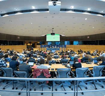
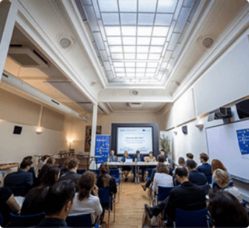
Memories of last year
We have dedicated tracks for every industry Whether you want to hire tech’s top talent meet with the policymakers
Event Speakers
Explore flexible pricing plans
Single day pass
One catered lunch
Afternoon snacks
Fun swag
Entrance Afterparty
VIP seat with food
Unlimited Entrance
Afternoon snacks
One catered lunch
Fun swag
Our official sponsors
We have dedicated tracks for every industry Whether you want to hire tech’s top talent.


contact
Contact Us
For more information on sponsorship, participation opportunities and logistics please contact:
- Biju Saith
- Project Director
- In2Space
- biju@ejtemaat.com
- +966 50 680 7038
Register Your Interest
We're delighted to learn of your interest in joining our forum! Kindly take a moment to fill in your details to register for this event by submitting the form below. A member of our team will promptly reach out. We look forward to welcoming you to the event!
About venue
To be announced
Gotham Hall
1356 Broadway, New York NY 10018, USA
Entry Time
Day 01:
09 am
Day 02:
12 pm
Day 03:

